It took a bit of time to finish data management. At present external GPX/KML sources can be imported into MapTrek (with respect to the modern Android architecture, so only selecting files from Download Manager and mail attachment are available at the moment). Track data and statistics can be viewed, it can be shared (exported) in alternative format. It means that you can export native track to well known format, or share track with anyone else. Waypoints and tracks can be edited in minimal way - name, description and color can be altered. All amendments are automatically saved. Unnecessary data sources can be hidden or permanently removed. In future I plan to add possibility to move waypoints and tracks from one …

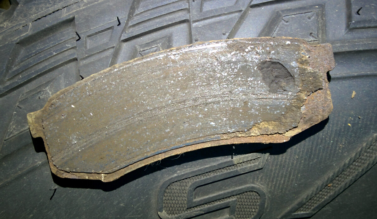
Еду по пробкам, никого не трогаю, вдруг заскрежетали задние колодки. Бывает, надо будет поменять, на днях ехать в Санкт-Петербург. Но не успеваю доехать до дома, как вдруг слышу сзади под днищем блямц-клумц. Думаю, наехал на что-то. Впереди пробка, нажимаю на тормоз, а тормозов то нет! Мать! Первая передача, ручник... затормозил. Гараж недалеко, пополз туда. Я уже догадывался, что случилось, это уже было со мной на предыдущей семидесятке.
Development of MapTrek is going in full steam. The following is done in less then a month:
-
Maps download from application. I consider downloading and copying maps by hand not acceptable in 21th century. Despite the fact that this is a temporary solution, because I more and more think that default MapsForge maps are bad, I have implemented maps downloading from within application. If you zoom a map to the 8th level or more and no map for that area is present application will advice to download a suitable map file. Maps are taken from public MapsForge repository and it has one major disadvantage - repository does not cover the whole world, some countries are missing. Personally I find OpenAndroMaps more …
Long time ago I have started development of Androzic application. That days it was Android 1.6 and OziExplorer maps which I was using for navigation. Since that everything changed. Now Android is totally different, OziExplorer maps for my region are 30 years old and new maps are encoded in new proprietary format. After I have noticed that I didn't use ozf maps for more then a year I decided to write a new application with totally different concept in mind.
After a long planing and research period, on August 26 2015 I started development of MapTrek. It is written with the following concept in mind:
- Fast vector OSM-based maps
- Lightweight and modern design
- Intuitive user interface
As always I …
