Why?
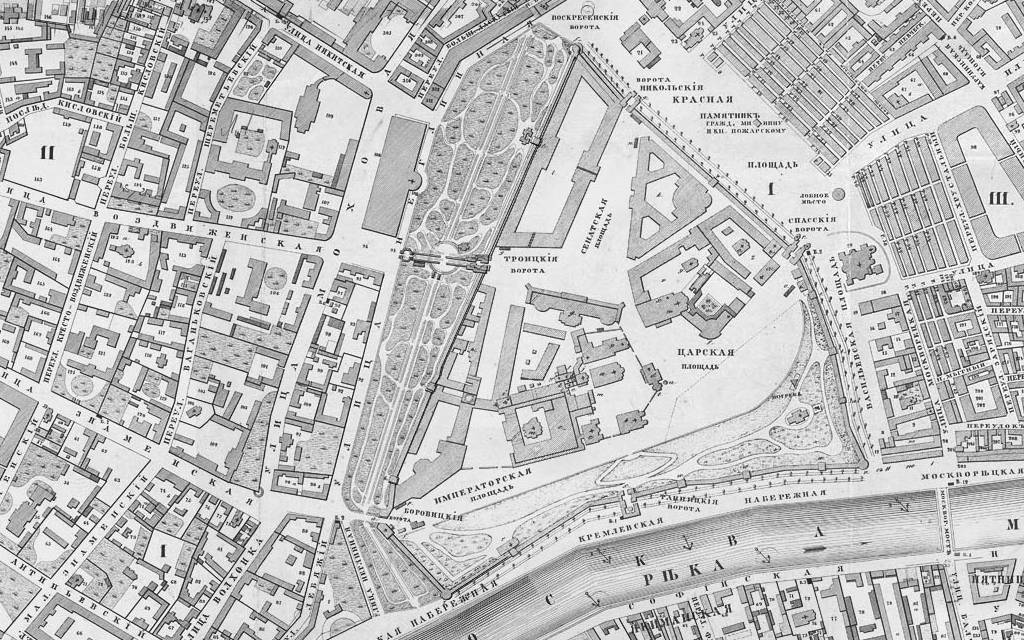
There are situations when a map comes as a one large graphic file. It can be an old-time scanned map, or a software generated water reservoir depth map, or downloaded map of a nature reserve park. Even in this case there are options to import such map in Trekarta. All you need is find a tool that will convert it to MBTiles format. And today I will show you how to do this by creating a usable map from scanned old-time map of Moscow dating back to the year of 1852.
The problem
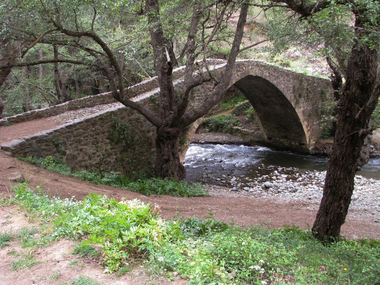
On your trip to Cyprus you might want to see three beautiful medieval bridges: Roudia Bridge, Kelefos Bridge and Elia Bridge.
Having personal map server lets me make maps the way I want. Comparing to default MapsForge maps I have added a lot of additional information: peaks, mountain passes, screes, cliffs, cave entrances, glaciers and springs for hiking; fords, power lines, various barriers and ferry routes for navigation; guest houses, camp sites and attraction places for traveling. Also I very much wanted to add heights to 3D buildings, but MapsForge format did not support it. After some consideration I decided to hack it a little bit. But this resulted in lots of amendments to map writer, so I went further and implemented colorful buildings. This feature requires map regeneration. I plan to run it for a hole world in two weeks but for now I have prepared an area for demonstration: open this link in Trekarta and "look" around. By the way, have you already found out how to view map in perspective? If not here is the hint: use two-finger slide.
Country maps are rectangular. Even if a country is round the map will be rectangular. Yes, it will be visually clipped by country boundary and will look like a circle but it will be stored and processed by application as a rectangle. It does not harm when you operate one map at a time, but if you want to combine several adjacent maps it's a pain. There is no proper way to find out if the map does not contain data because it is clipped or just because there is no data for that area. That's why you have to harvest all maps around. It requires all of them to be opened and consumes extra resources. That's why I decided …
I do not use landscape orientation in everyday life. That's why it is hard to come up with the proper layout. But after I make a decision that all panels will be mostly the same but will cling to the right edge further development was straightforward. For me the result looks great, I even want to try to use it for a while.
Meanwhile I have added automatic night mode (will be available only in paid version), fixed track drawing (now gaps are correctly shown), and greatly improved UI of coordinates sharing.
